
Mission Need
Federal agencies, from emergency response and environmental protection to infrastructure planning and national security, rely on Geographic Information System (GIS) data to carry out their missions. This data is generated and maintained across multiple agencies, but older, disconnected systems made it hard to share data securely, consistently and at scale.
To solve this, the Department of the Interior’s (DOI) Office of the Chief Information Officer led a bold governmentwide initiative to modernize how GIS data is hosted and shared. This effort established a centralized, cloud-based environment that improves access, reduces costs, accelerates response times and gets critical location-based information to decision-makers faster.
Solution
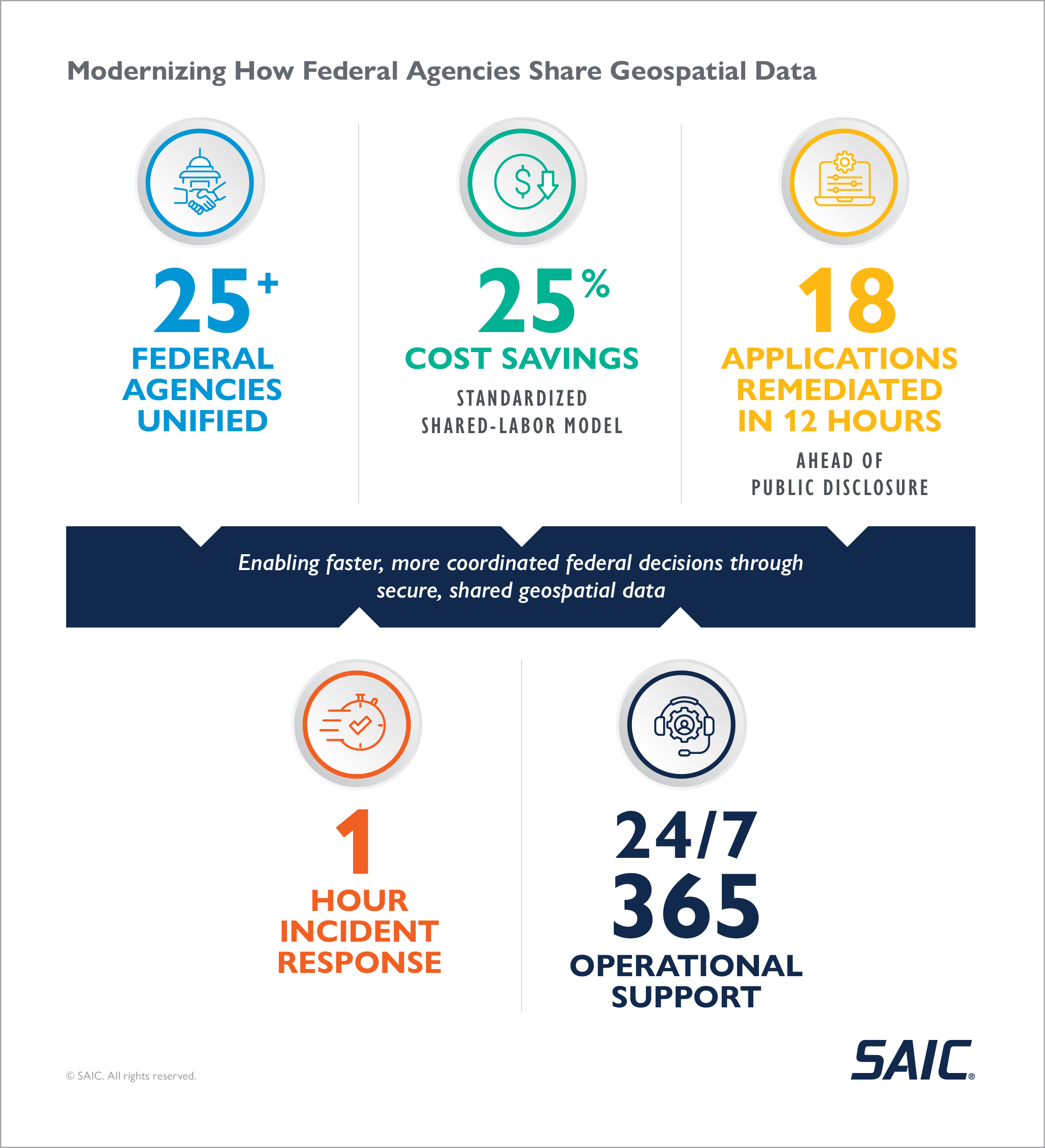
With leadership from DOI and collaboration across more than 25 federal entities, SAIC helped design, implement and operate GeoPlatform, a secure, scalable cloud environment purpose-built for Esri-based GIS data.
Key solution elements include:
A consolidated platform that connects federal entities, streamlining access to geospatial data across the federal enterprise and eliminating duplicative systems and contracts.
Flexible architecture that adapts to a wide range of agency needs.
A FedRAMP-authorized, cyber-hardened environment that meets federal compliance standards.
Standardized upgrades and patching processes that create efficiencies of scale and improve reliability across tenants.
Common best practices identified across tenant applications to drive reuse and performance.
Budget planning with standardized tenant costs for GIS support and maintenance, achieving 25% cost savings on shared labor.
AWS consumption trend analysis that monitors GIS imagery usage and recommends optimization strategies to manage costs.
Security mitigation across multiple applications simultaneously. Most recently, SAIC remediated 18 applications within 12 hours of discovering a critical GIS vulnerability, well before public disclosure.
24x7x365 support desk for continuous availability and fast issue resolution.
Support for cross-agency tools like the Interdepartmental Imagery Publication Platform to centralize imagery data.
Geospatial data services support missions like land management, disaster recovery, mineral exploration and public recreation.
Mission Impact
Click image to enlarge
GeoPlatform has fundamentally changed how federal agencies use geospatial data to plan, respond and make decisions. By centralizing GIS infrastructure in a secure, cloud-based environment, DOI has enabled agencies to operate from a shared and trusted geospatial foundation.
Agencies now access authoritative data in near real time, improving decision quality during time-sensitive missions such as disaster response, land and resource management and infrastructure planning. Instead of duplicating systems and data purchases, agencies now collaborate across organizational boundaries, reducing redundancy while accelerating the delivery of actionable insights to leadership and field operators.
Reliability and continuity are critical when geospatial data underpins mission execution. When an unexpected outage affected a key component of the platform, the support team restored service within an hour, minimizing operational disruption and reinforcing confidence in GeoPlatform as mission infrastructure rather than a standalone IT system.
With SAIC’s technical partnership, DOI continues to evolve GeoPlatform into a cloud-native GeoCloud, integrating artificial intelligence and natural language tools that lower the barrier to analysis and expand access to geospatial insights beyond technical specialists. Even in a constrained budget environment, GeoPlatform stands out as a cost-effective, enterprise solution that strengthens interagency collaboration, improves operational readiness and enables agencies to deliver timely, informed outcomes that directly serve the public.
Explore how SAIC supports federal civilian, state and local agencies with scalable, secure solutions that drive innovation, enhance mission integration and strengthen services for citizens nationwide.